

Industries · 6 min read
Object detection on satellite imagery finds every house inside the pipeline buffer
A proposed corridor over a basemap, houses and barns proposed as boxes, a GIS analyst approving each one, and summer leaf cover as the season that hides roofs.
Summary
This post follows a proposed pipeline corridor drawn over satellite basemaps, where every house, barn and yard inside the consultation buffer has to be found before the land team makes a call. It covers proposing structures as boxes, the GIS analyst reviewing and approving each one, the things that look like houses and are not, and summer tree cover as the season that hides roofs the winter imagery shows. It is written for GIS and land teams on pipeline routing projects.
Sheikh Srijon · GTM Lead · Sep 25, 2026
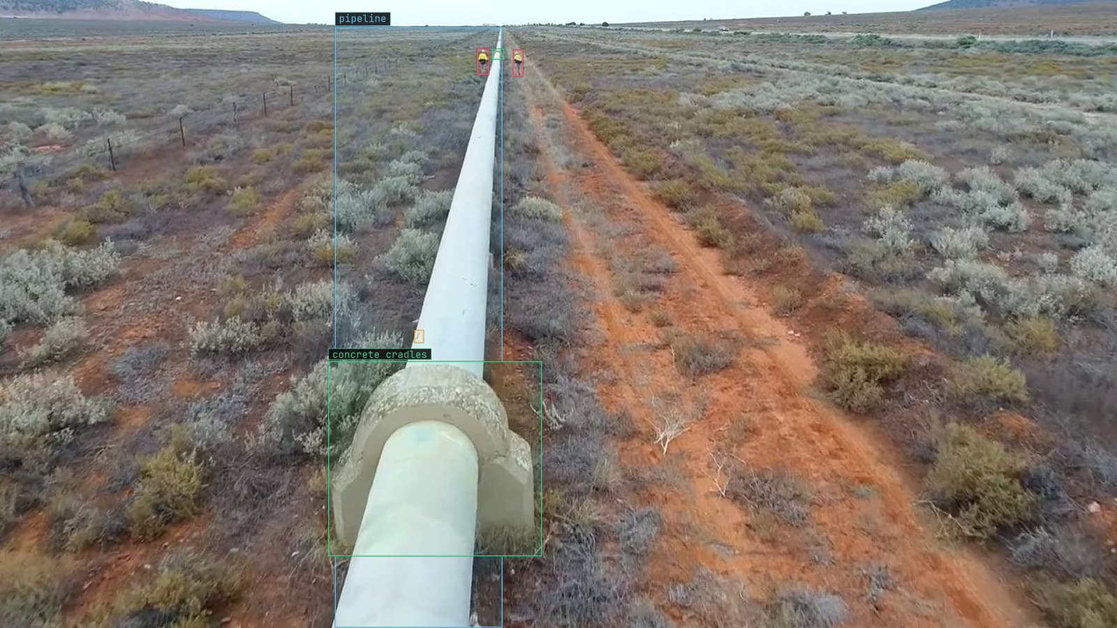
Pipeline run across scrub from a customer drone survey, cradles boxed and rust flagged
The proposed corridor runs two hundred kilometres across farmland and scrub, and the consultation buffer either side of it takes in every structure the land team has to contact before a survey crew can set foot on the ground. The GIS analyst on the project has the corridor as a line on a basemap and the buffer as a polygon around it.
Her job in January is to find every house, barn and yard inside the polygon by scrolling the imagery at a scale where a roof is the size of a fingernail. On the last corridor it took her six weeks, and the land team still found four houses she had missed, all of them under trees.
Nobody wants to be the analyst who missed the house. The person who lives in it wants that even less.
Everything inside the buffer needs a box
The corridor and the buffer come from the routing engineers, and the imagery comes from whichever basemap the project licenses. What the analyst adds is a box on every structure inside the polygon, with a class: house, barn, yard, and a category for the things she is not sure about. Each box becomes a record for the land team, with a coordinate, a class and a link to the imagery, and the land team's call sheet is that list.
The oil and gas work behind our numbers, 12k+ precision image annotations delivered, is mostly boxes like these, on imagery of corridors and pads where the question is what is there and where exactly.
Object detection on a basemap is a small object problem
A house on a basemap at the project's working scale is a rectangle of a few dozen pixels, seen from directly above, with no walls visible and a roof that is the same grey as the road beside it. A barn is the same rectangle, longer. A yard is a patch of bare ground with a vehicle on it. The task is object detection, a box per structure with a class, but a detector trained on ground-level imagery has never seen a roof from above and finds nothing.
So the model is trained on the project's own basemap tiles. The three classes are typed once, Lexi proposes boxes across the buffer, and the analyst checks each one before anything trains, in the verification pass the labeling guide describes. Her first afternoon of checking is mostly un-boxing: hay bales boxed as houses, a grain silo's shadow boxed as a barn, a stock pond boxed as a yard. Each one she removes is a thing the next version has learned is not a house.
The GIS analyst reviews and approves each proposed structure
The model proposes and the analyst disposes. Every box inside the buffer arrives in her queue with the imagery around it, and she approves it, reclassifies it or removes it, at a rate of a few seconds each rather than a few minutes each. The queue is sorted so the boxes the model was least sure of come first, because those are the ones where her eyes matter, and the confident houses at the end of the queue are checked in a pass that takes a morning.
The analyst on the January corridor keeps a count of swimming pools in a column of her own, because a pool in the middle of a wood is a house under trees, and the model finds pools more reliably than it finds roofs under canopy.
The approvals are the deliverable. The land team gets the approved list, with each structure's coordinate and a snapshot of the imagery, and the rejected boxes stay in the record as rejected, so a second analyst can see what was considered.
Barns, yards and the things that are not houses
The reason the classes matter is that the land team's call in February is different for each. A house means a resident and a consultation letter. A barn means a landowner who may not live there. A yard with vehicles means a business, and a business has different notice requirements. A box with the wrong class sends the wrong letter, which is a smaller mistake than a missed house and a more frequent one.
I think the class list should be short and the fourth class, unsure, should be used freely. An analyst who has to decide between barn and house on a rectangle under a tree will guess, and the guess becomes a label the next version learns from. An unsure box goes to the land team as a structure to check and to the training set as nothing, which is what it should be.
Summer leaf cover hides the roofs the winter imagery shows
The corridor's basemap was captured in July. In July the tree cover along the creeks inside the buffer is full, and a house that sits under two oaks is a patch of canopy with a driveway leading into it. The same house in February imagery is a grey rectangle with bare branches over it. The four houses the land team found on the last corridor were all under trees, and the analyst had been looking at July.
The drift catalog calls this the season turned: the same structures, the same definition of a house, different pixels, and the slowest and most predictable form of the input moving. On a routing project the fix is to pull winter imagery for the wooded stretches of the buffer and run the model on both. The summer frames stay in the training set alongside the winter ones, so the model that runs on next year's corridor has seen a roof under canopy and a roof without it. The driveway leading into the trees is a label in its own right, and on the January corridor it found two of the four.
The approved set is true for its imagery date
The list the land team gets is true for the day the imagery was captured. A house built on a parcel in August is not in July's basemap and will not be in the list, however good the model or the analyst. The record carries the imagery date on every box for that reason, and the land team's process treats the list as a starting point that the drive-through survey completes.
LexData takes the corridor model through its whole life. You type what to look for, Lexi puts a box on every tile, and a person checks each label before anything trains on it. The model then runs on the next corridor's basemap, in the cloud or on your servers. Tiles it is unsure of come back to the analyst, the corrections retrain it, and the new version replaces the old one with no downtime. The hay bales and silo shadows from the January corridor are what the version on the next corridor has learned to leave alone, and the analyst's six weeks become a week of approvals.
See it on your own footage.
Start with your footageMore in Industries
Industries · 7 min read
Counting the screws in a kit with object detection over the bench
A camera over the kitting bench counts every screw and bottle one box at a time. Exact for kits, a band for cases, and a half-hidden item is a written rule.
Rajiya Sultana · Sep 25, 2026
Industries · 7 min read
Automated water meter reading with a camera in the vault
Ten digit classes in a fixed row turn a truck roll into a frame. A rolling digit and condensation on the glass are the frames that come back to a person.
Stephen Biswas · Sep 25, 2026
Industries · 7 min read
Body-in-white inspection with a station camera on unpainted steel
Dents on a bare body shell hide in the reflections. Masks give the extent, a second pass decides reportable, and a tightened tolerance is a spec change.
Finn Ellingwood · Sep 25, 2026